North Eastern Space Applications Centre (nesac.gov.in): Contacts
North Eastern Space Applications Centre
Central Government · Autonomous Bodies · Science, Technology & Research
Updated 13 Nov 2026. Contacts checked 13 Nov 2026.
This is an independent guide, not a government website.
Is this website working right now?
Open this page in a browser with JavaScript to run the live check.
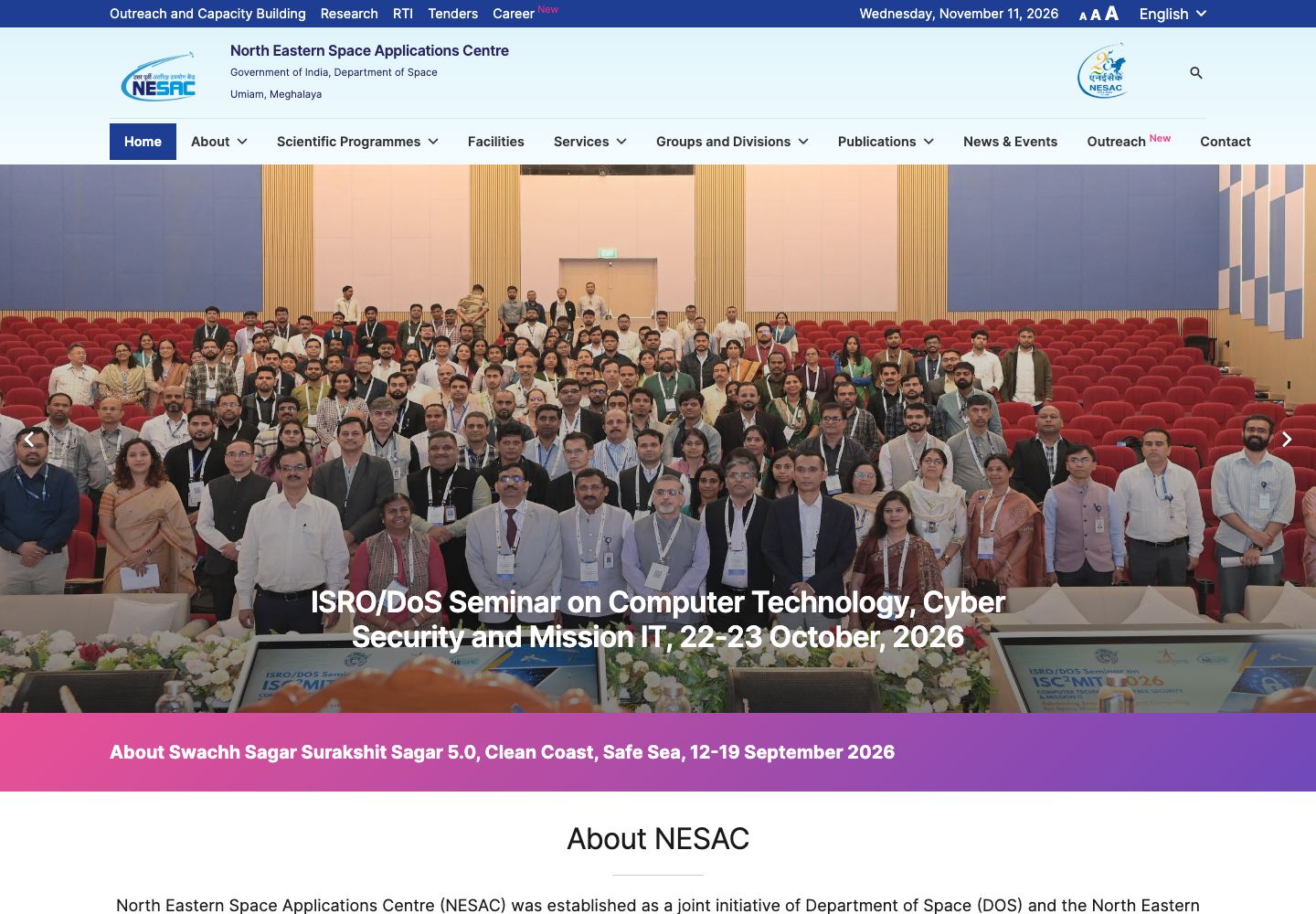
North Eastern Space Applications Centre (NESAC) was established as a joint initiative of Department of Space (DOS) and the North Eastern Council (NEC) and came into being on 5th of September, 2000. The Centre helps in augmenting the developmental process in the region by providing the advanced space technology support.
Reach the department
Tel: 0364-2308704 [email protected]
Tel: 0364-2308781 [email protected]
Artificial Intelligence/Machine Learning/Deep Learning applications in Earth Observation
- Step 1
Land Use Land Cover Mapping: Multi-temporal (rabi, khariff and zaid) Resourcesat 1 and 2 LISS III imagery used in a supervised classification framework to develop LULC mapping modules using random forest and UNET convolutional neural network architecture on python to segment the imagery into 48 classes at a scale of 1:50000. This project established the ability of machine learning and deep learning to accurately (validation accuracy is 85.26%) predict the land cover classes and thereby improve the temporal availability of land cover maps from 5 years to 1 year.
- Step 2
Meteorological/climate applications: AI/ML/DL can be used in a variety of predictive problems in meteorological/climate studies including time series forecasting, variable downscaling, model parameterization and climate attribution. One study on rainfall prediction uses deep learning and evolutionary computing to estimate rainfall at several time steps (6 hrs, 12 hrs, 24 hrs, 48 hrs).
- Step 3
Cryosphere applications: Several tasks in cryospheric studies such as snow cover mapping, snow melt estimation and glacier mass balance estimation has been implemented using deep learning. Due to paucity of glacier mass balance data, a transfer learning approach was demonstrated with initial weights of a neural network obtained using datasets based in Europe and training was continued using the sparse Himalayan dataset to extend the ability of deep learning to regions with limitations in accessibility.
The right desk for your problem
| For | Published desk | Phone | |
|---|---|---|---|
| Director, NESAC / +91 364 2308 702 | Dr SP Aggarwal | [email protected] | |
| Group Director, Remote Sensing Applications Group (RSAG) & Deputy Project Director, NER-DRR / +91 364 2308 709 | Dr KK Sarma | [email protected] | |
| Head, Agriculture and Soil Division (ASD) and Head, Programme Planning and Evaluation Group (PPEG) / +91 364 2308 712 +91 364 2308 705 | Dr BK Handique | [email protected] | |
| Head, Forestry and Ecology Division (FED) / +91 364 2308 717 | Dr. Kasturi Chakraborty | [email protected] | |
| Head, Geoscience Division (GSD) / +91 364 2308 721 | Shri M Somorjit Singh | [email protected] | |
| Head, Urban and Regional Planning Division (URD) / +91 364 2308 719 | Dr. Jenita M Nongkynrih | [email protected] | |
| Head, Water Resources Division (WRD) / +91 364 2308 713 | Dr. Diganta Barman | [email protected] | |
| Head, Geoinformatics and IT Division (GID) / +91 364 2308 714 | Dr. Dibyajyoti Chutia | [email protected] | |
| Head,Space and Atmospheric Science Division (SASD) / +91 364 2308 740 | Dr. Shyam S Kundu | [email protected] | |
| Head, Satcom and UAV Division (SUD) and Civil and Maintenance Division (CMD) / +91 364 2308 750 | Shri Ramani Kumar Das | [email protected] | |
| Program Coordinator, Outreach & Capacity Building / +91 364 2308 716 | Dr Jonali Goswami | [email protected] | |
| Controller of Administration / +91 364 2308 704 | Shri Avaneesh Shukla | [email protected] | |
| Administrative Officer / +91 364 2308 707 | Shri Shah Nikunjkumar Mukeshbhai | [email protected] | |
| Accounts Officer / +91 364 2308 762 | Shri Subakordor Syiemlieh | [email protected] | |
| Purchase Officer / +91 364 2308 768 | Mrs. Phiba Marbaniang | [email protected] | |
| 1 / 0364-2308716 | Smt. Jonali Goswami Sci/Engr ‘SF’ (Chairperson cum Presiding Officer) | 0364-2308716 | [email protected] |
| 2 / 0364-2308720 | Smt. Pratibha T Das Sci/Engr ‘SF’ (Member) | 0364-2308720 | [email protected] |
| 3 / 0364-2308724 | Dr. Pebam Rocky Sci/Engr ‘SF’ (Member) | 0364-2308724 | [email protected] |
| 4 / 0364-22521221 | Ms. Joy Grace Syiem Programme Manager North East Network Shillong (Member) | 0364-22521221 | [email protected] |
| 5 / 0364-2308760 | Smt. Emica Marbaniang Sr. Assistant ‘A’ (Member Secretary) | 0364-2308760 | [email protected] |
Do it online: useful services and information
The imagery obtained from UAVs can immensely support in many applications ranging from large-scale mapping, disaster assessment, infrastructure planning, urban modeling to vegetation structure mapping. Specifically in the NE region of our country with limited connectivity and difficult terrain condition, the local planning and developmental activities can be greatly improved by the UAV survey. NESAC has conducted 60+ UAV surveys until the date to assist different line departments and research work in NER. NESAC has also facilitated all the State Remote Sensing Centres of NER in establishing UAV facility under the project “Use of Unmanned Aerial Vehicle (UAV) Remote Sensing (UAV-RS)) for the States of NE region (NER)” funded by NEC.
Telemedicine is one of the vital SATCOM application programs of ISRO. The Telemedicine Program is an ICT enabled process of synergising benefits of Satellite communication and information technology with Biomedical Engineering and Medical Sciences to deliver the health care services to the remote, distant and underserved regions of the country. ISRO made a modest beginning in telemedicine using satellite communication in the form of a telemedicine pilot project in the year of 2001, connecting Apollo Hospital at Chennai with the Apollo rural hospital at Arogonda village in the Chittor district of Andhra Pradesh. Now a number of telemedicine networks are operational all over the country.
Unmanned Aerial Vehicle – UAV popularly known as drone, is an airborne system or an aircraft operated remotely by a human operator or autonomously by an onboard computer. There are two broad classes of UAVs – Fixed wing and Rotary based. UAV combined with remote sensing technology have been creating new vistas in global scenario to acquire the geospatial data on land resources and environment. The imagery obtained from UAVs can immensely support in many applications ranging from large-scale mapping, urban modelling to vegetation structure mapping. Specifically in the NE region of our country with limited connectivity and difficult terrain condition, the local planning and developmental activities can be greatly improved by the UAV survey.
IT and GeoInformatics Group is the backbone of the Centre to provide various operational IT and GeoInformatics related services. The group is responsible for establishing high technology infrastructure support to enable NE states to adopt space technology inputs for their development. Following are the major objectives of the group:
Photogrammetry and UAV division provides complete solutions for all standard tasks in digital Photogrammetry services such as Aerial Triangulation (AT), DSM/ DTM generation, Photogrammetry mapping, stereo compilation, topographic and planimetric feature extraction, orthophoto production, color balancing, contour generation, alignment studies for canal/road/railways, cut and fill volume estimation – volumetric analysis, L-section & cross-section profile generation, 3D terrain visualization and photo-realistic 3D city modeling.
The website
Official sources
- North Eastern Space Applications Centre. Read 11 Nov 2026.
- Disaster Management Support – NESAC. Read 13 Nov 2026.
- Contact – NESAC. Read 13 Nov 2026.
- Who’s Who – NESAC. Read 13 Nov 2026.
- Right to Information – NESAC. Read 13 Nov 2026.
- Research / Scientific Programs – NESAC. Read 13 Nov 2026.
- UAV Applications Service – NESAC. Read 13 Nov 2026.
- Research Publications – NESAC. Read 13 Nov 2026.
- Former Directors of NESAC – NESAC. Read 13 Nov 2026.
- Satellite Communication Applications – NESAC. Read 13 Nov 2026.
- UAV Applications – NESAC. Read 13 Nov 2026.
- IT & Geo-Informatics – NESAC. Read 13 Nov 2026.
- Photogrammetry & UAV Applications – NESAC. Read 13 Nov 2026.
- IGOD directory body classification. Read 13 Nov 2026.